Eleven Highest Peaks Track Overview
The Eleven Highest Peaks Track follows the popular Main Range Track (my post on Main Range Track is here) with detours to the peaks. Australia’s Eleven Highest Peaks are all above 2,000 m and are located not too far from each other in Kosciuszko National Park. It looks like there is no complete agreement on which peaks are included in the list, and there are different variations of the track: some of them include ten, eleven, or fifteen peaks. You can check a list of Australia’s ten highest mountains according to Geoscience Australia on their website. We climbed seven peaks:
- Mount Twynam – 2,195 m
- Tenison Woods Knoll – 2,136 m
- Carruthers Peak – 2,145 m
- Mount Townsend – 2,209 m
- Mount Kosciuszko – 2,228 m
- Unnamed peak on Etheridge Ridge – 2,180 m (Update from January 2023: the area is closed for plant rehabilitation)
- Rams Head Nort – 2,177 m
We skipped these peaks:
- Mount Northcote, 2,131 m
- Alice Rawson Peak – 2,160 m
- Abbott Peak – 2,145 m
- Rams Head – 2,190 m
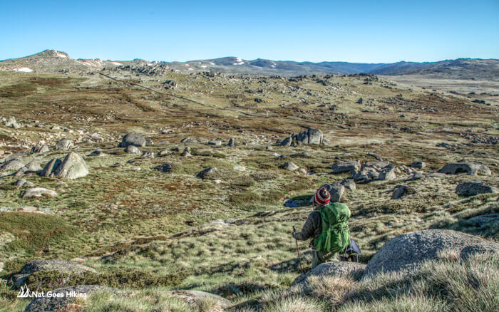
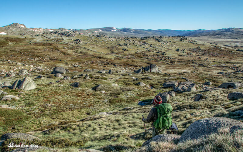
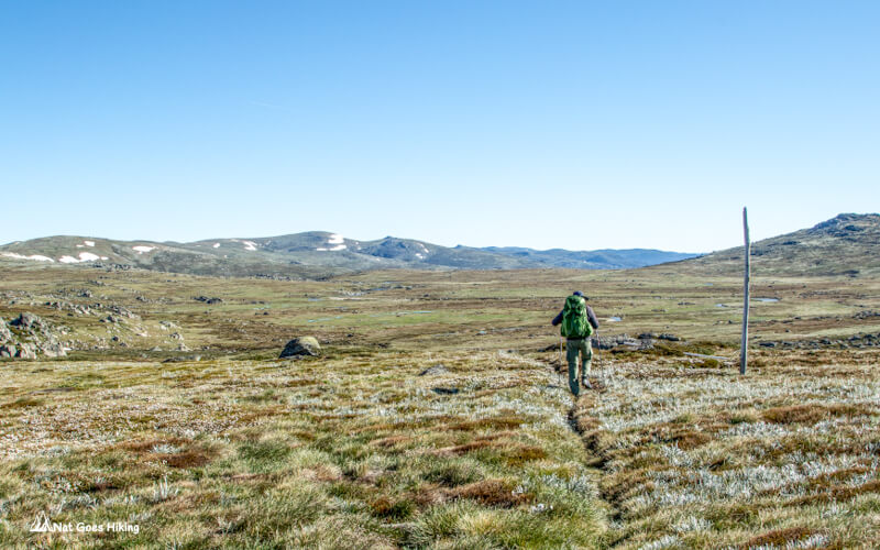
The trail starts at Charlotte Pass and follows the Main Range Track. To summit the peaks, you need to detour from the trail. Detours to most of the peaks are not clearly marked with no well-defined trails. The Main Range Track is very popular; it gets especially busy during long weekends, but when you detour to the peaks, you won’t see many people.
Day 1 of Highest Peaks Track: Charlotte Pass to Muellers Pass, 22 km
Three peaks: Mount Twynam (2,195 m), Tenison Woods Knoll (2,136 m), Carruthers Peak (2,145 m)
Charlotte Pass – Blue Lake
We arrived at Charlotte Pass around 7 am, and there were quite a few cars there. If you come on a long weekend, it’s better to come as early as possible, it will be easier to find a parking spot closer to the start of the trail.
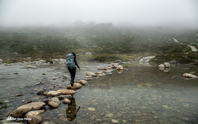
The track starts as a paved trail that descends to the Snowy River. After about 700 m, you need to cross the Snowy River and Club Lake Creek by a path of stepping stones. These stones are slippery when wet.
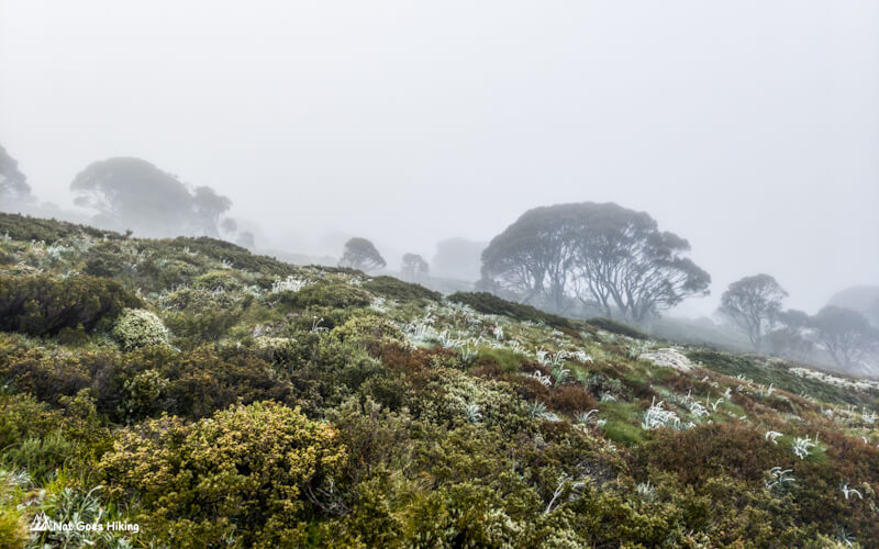
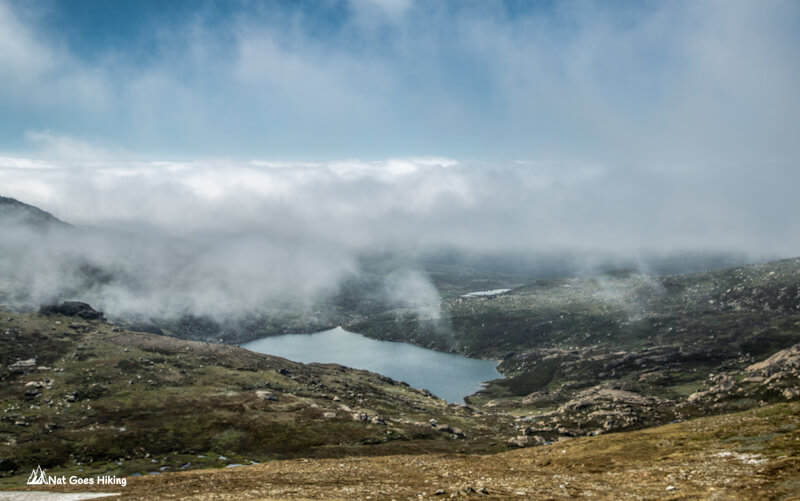
It was misty in the morning, so we could not see much for almost 2 hours; it started clearing at about 9 am.
From the river, the trail goes uphill for about 3 km and takes you to the turnoff to the Blue Lake lookout which is a short walk (around 500 m) from the main trail. As of January 2023, you cannot go beyond the lookout, as the area is closed for plant regeneration.
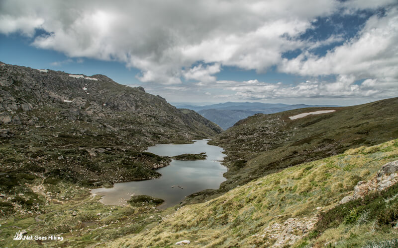
Blue Lake is the largest of the four cirque lakes on mainland Australia. All four of them are located in Kosciuszko National Park. The other three are Lake Albina, Club Lake, and Lake Cootapatamba.
Blue Lake – Mount Twynam – Tenison Woods Knoll – Carruthers Peak
From Blue Lake lookout, return to the main trail and head west until you get to a saddle with a stunning view of the ranges. At a saddle, there is a three-way intersection with a Main Range Track signpost. Turn right here to get to Mount Twynam and Tenison Woods Knoll.
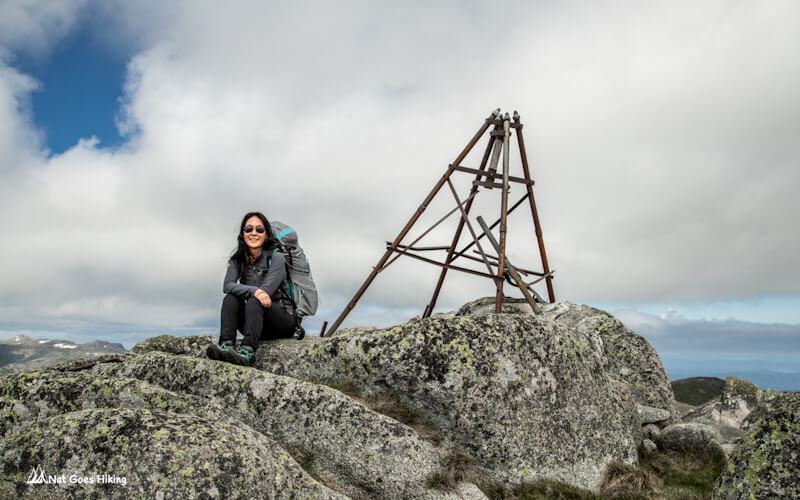
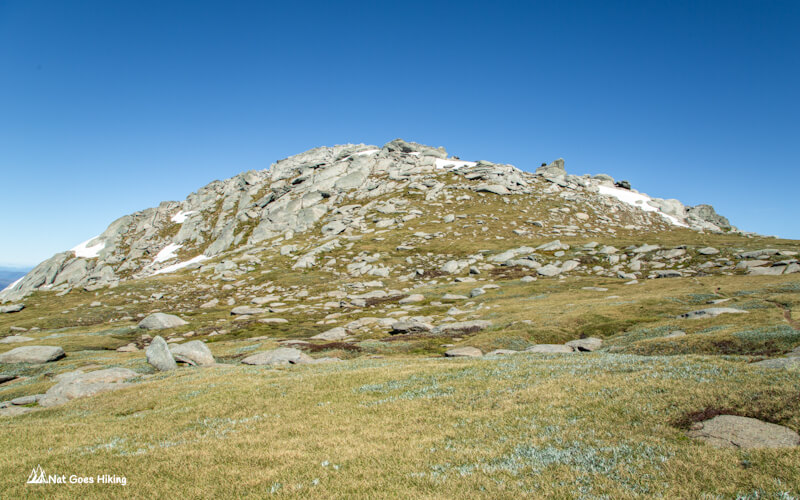
Mount Twynam (2,195 m) was our first peak. On the way to the top of Mount Twynam, we enjoyed a very nice view of Blue Lake.
Tenison Woods Knoll (2,136 m) is next to Mount Twynam. We left our backpacks at the bottom and hiked up. There is no marked trail to the peak. For some reason, this peak is not included in some of the lists of the highest mountains. We were confused: we thought we had climbed Watsons Crags (2,020m), but it was Tenison Woods Knoll.
After descending from Tenison Woods Knoll we returned back to the Main Range walk and hiked uphill. Further, the stone path goes up to Carruthers Peak (2,145 m).
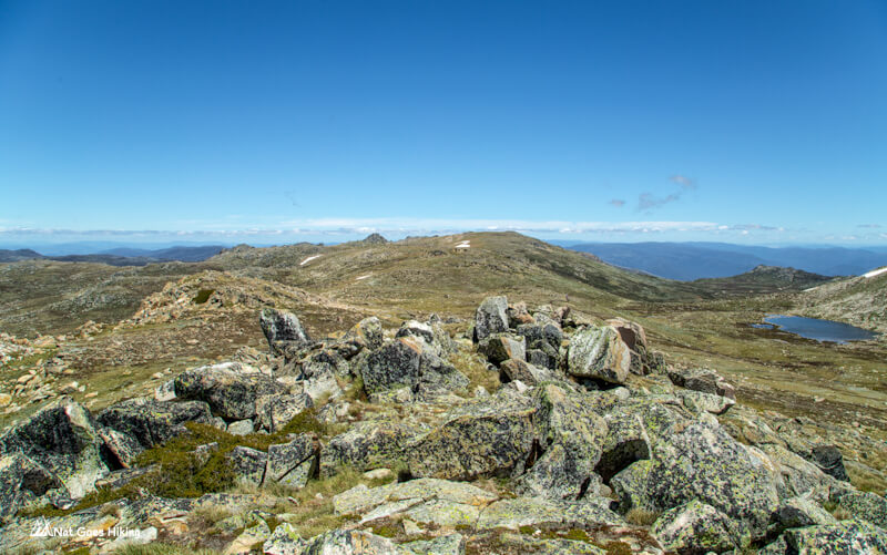
Carruthers Peak – Muellers Pass
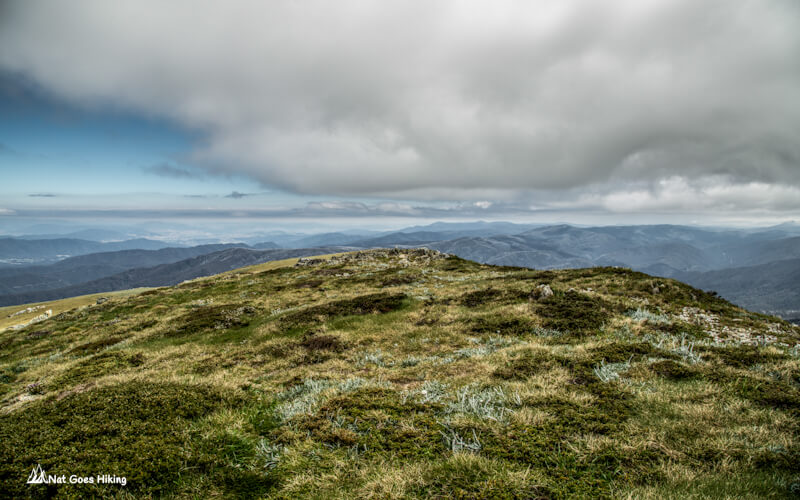
More stunning views of the ranges from Carruthers Peak. From the peak, the track winds down the ridge. Soon, the stone path turns into a metal grate. From here, you will see beautiful Lake Albina.
Around 1 pm, we took a break and had lunch not far from the Muellers Pass.
First night camp on Muellers Pass
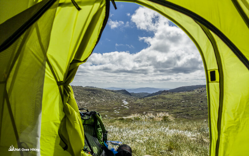
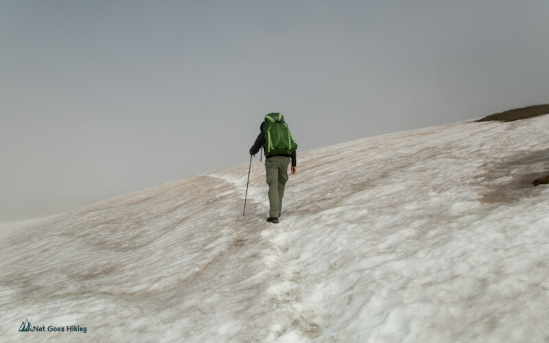
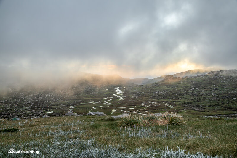
Soon after lunch, we got to our first night camp on Muellers Pass. There, you have access to water from Wilkinsons Creek. In the evening, the fog rolled through the pass. As Muellers Pass is exposed to the winds, it was quite windy during the night. Besides, the temperature dropped to below zero. Even in summer, you must be prepared for cold weather, especially at night. The weather in the mountains can change very quickly from sunny to stormy, rainy, and windy in a short period of time.
Day 2 Highest Peaks Track: Muellers Pass – Mount Townsend – Mount Kosciuszko – Rams Head North, 17 km
Three peaks: Mount Townsend (2,209m), Mount Kosciuszko (2,228 m), Unnamed peak on Etheridge Ridge (2,180m), Rams Head North (2,177m)
Muellers Pass to Mount Townsend and back
In the morning, we headed to Mount Townsend. While it’s a good idea to leave your tent and backpacks in your camp and go summit the three peaks (Mount Townsend, Abbott Peak, and Alice Rawson Peak), we packed our tent and started hiking towards Mount Townsend. We thought our backpacks were not super heavy, and we were only planning to summit Mount Townsend.
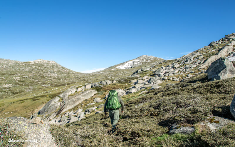
We chose Mount Townsend over Abbott Peak and Alice Rawson Peak, as it is the second-highest peak on the mainland of Australia. Mount Townsend is quite off the beaten track; it’s away from Main Range Walk, and we met only four other hikers on the way there and back.
There is a narrow trail leading from Muellers Pass to Mount Townsend. When we got to the bottom of Mount Townsend, we left our backpacks there and hiked up to the top.
After having some snacks, we headed back to Muellers Pass.
Muellers Pass – Mount Kosciuszko
We followed Main Range Walk towards Kosciuszko. The trail climbs a stone path, which soon gives way to rubber mesh. On your left, there is the Snowy River Valley, and fractured granite on your right. Finally, the trail brings you to the intersection with the Summit Track. At the intersection, turn right towards Mount Kosciuszko summit. It is 990 m to the summit from here.
Since it was Christmas break, no wonder there were lots of people hiking up to Mount Kosciuszko summit.
If you come on a long weekend or a Christmas break, it’s best to go to Mount Kosciuszko early in the morning to avoid crowds. More than 100,000 people climb Mount Kosciuszko every year, most of them doing it in summer, so you can imagine how many people were there on Christmas break.
Mount Kosciuszko – Etheridge Ridge
From Mount Kosciuszko, hike back to the intersection and then walk another 680 m to the Rawson Pass. Rawson Pass is a three-way intersection where the old Kosciuszko Road from Charlotte Pass meets the metal walkway from Thredbo. There is a toilet there, which is the highest public toilet in Australia.
The next peak after Mount Kosciuszko is an unnamed peak on Etheridge Ridge (2,180 m) next to Rawson Pass. After having lunch with a great view there, we headed to Rams Head North (2,177 m). Update from January 2023: The Etheridge Ridge area is closed for plant rehabilitation.
Etheridge Ridge to Rams Head North
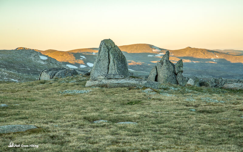
After getting down, we walked on the metal path leading to the Thredbo chairlift. That night, we planned to camp near North Rams Head. Even though it is just a short hike away from the main track, it feels quite isolated, maybe because there is no marked path leading there.
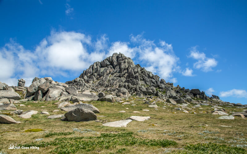
Personally, North Rams Head was my favorite peak on this trail. It is a stack of huge rocks and looks spectacular. There is a large flat grassy area in front of North Rams Head and a creek to get water – the perfect place for camping. We pitched a tent next to a huge boulder that sheltered us from the wind.
Day 3 of Highest Peaks Track: Rams Head North – Charlotte Pass, 10 km
This morning we walked back to Charlotte Pass. You have the option to return following Thredbo-Kosciuszko walk to Rawson Pass and then take the Kosciusko Summit Walk to Charlotte Pass. We decided to take a shortcut, it is a cross-country hike, and we had to cross the Snowy River twice.
Things to keep in mind
- You must be prepared for weather changes. Even in summer, the temperature can drop dramatically, especially during the night.
- UV radiation is extremely high
- There are no marked trails to some of the peaks; some navigation skills are required
- There is mobile reception in some spots
Pingback: Main Range Walk: a Must Do Hike in Kosciuszko National Park
Pingback: Mount Bogong Hike (Alpine National Park) - Nat Goes Hiking