We did the Maragua Crater Trek mainly to see the dinosaur footprints at Niñu Mayu. But we enjoyed the scenery along the way just as much.
The Maragua Crater Trek starts about 30 km from Sucre, in Bolivia’s Chuquisaca region. You begin on a pre-Hispanic stone-paved trail; after that come red cliffs, striped hills, a waterfall and a village sitting inside a giant bowl of folded rock that looks like a crater.
We did this trek without a guide over 3 days in October 2025. In this guide, I share our day-by-day route, how to get to Chataquila from Sucre, where to stay, what it costs and what to know before you go.
Maragua Crater Trek at a Glance
Maragua Crater Trek: Quick Facts
- Trail type: Point-to-point multi-day trek
- Distance: 37.8 km / 23.5 mi
- Duration: 2-3 days
- Elevation gain: 988 m / 3,241 ft
- Elevation loss: 1,543 m / 5,062 ft
- Starting point: Chataquila
- Starting elevation: 3,640 m / 11,942 ft
- Ending point: Potolo
- Ending elevation: 3,079 m / 10,102 ft
- Highest point: 3,640 m / 11,942 ft
- Lowest point: 2,751 m / 9,026 ft
- Difficulty: Moderate
- Best season: Dry season (May to September)
- Accommodation: Basic accommodation
- Shops: Basic supplies: Limited snacks and drinks at some hostels in Chaunaca and Maragua
GPS note: Distance and elevation figures can vary between GPS devices and mapping platforms. The figures above are from our merged GPS track on Wikiloc.
Click the button below to download the Maragua Crater Trek GPX file.
Can you do the Maragua Crater Trek without a guide?
Yes, you can do the Maragua Crater Trek without a guide. There is no requirement to hire one, and you don’t need a tent either. Combis (shared minibuses) run to the start and back from the end, and there are hostels along the way.
You need to have navigation skills. Like most treks in Bolivia, the Maragua Crater Trek is not marked. Some sections can be a little confusing, so make sure to download an offline map and GPS track before leaving Sucre and check your position as you walk.
So overall, if you’re comfortable navigating with an offline map and happy to deal with a bit of uncertainty, hiking the Maragua Crater Trek independently is a realistic option.
How to get to the Maragua Crater Trek trailhead?
The Maragua Crater Trek starts at Chataquila Chapel, around 30 km from Sucre. It took us about 1 hour 20 min by combi (shared minibus). You need to catch shared transport heading towards Potolo and ask the driver to drop you off at Chataquila.
The combis leave from this combi station in Sucre.
We took an InDrive there for Bs 15 and arrived before 9 am.
We got this part wrong. The combi had just left, and the next one would go “when there are enough passengers”. So we ended up waiting for more than two hours. At 11:10 am, we finally rolled out and reached Chataquila about 1 hour 20 minutes later. There is no set timetable, so if you would like to complete the trek in 2 days, I recommend arriving earlier.
The fare was Bs 17 per person in October 2025. More recent Google reviews from 2026 put the fare at Bs 25. The fare rise seems to be linked to the Bolivian government’s removal of fuel subsidies, which pushed fuel prices up.
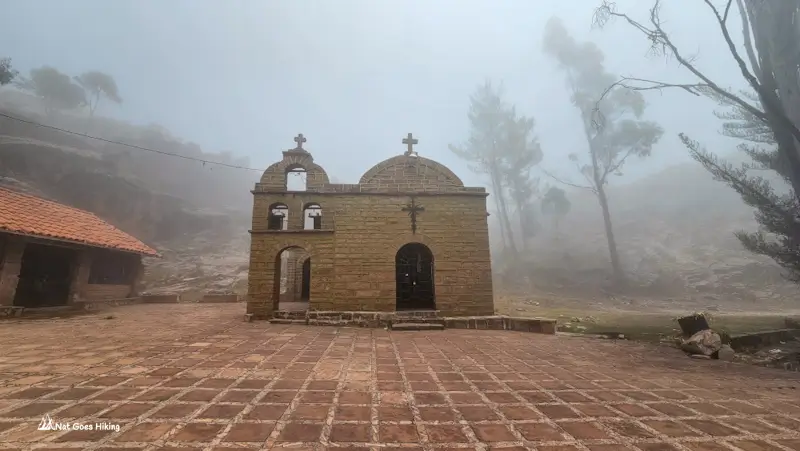
Ask to be dropped off at Chataquila Chapel, where the stone-paved pre-Hispanic trail begins. From here, the route descends towards Chaunaca before continuing towards the Maragua area.
Maragua Crater Trek: Day 1
Our original plan was to do the hike in two days, reaching Maragua on the first day. But we turned up at the trailhead around lunchtime. As we weren’t in a rush, we decided to stay overnight in Chaunaca and do the trek over three days instead.
Maragua Crater Trek. Day 1 Statistics
- Distance: 5.8 km / 3.6 mi
- Total time: 2 h 17 m
- Moving time: 1 h 40 m
- Elevation gain: 25 m / 82 ft
- Elevation loss: 794 m / 2,605 ft
- Starting elevation: 3,640 m / 11,942 ft
- Ending elevation: 2,865 m / 9,400 ft
- Highest point: 3,640 m / 11,942 ft
- Lowest point: 2,865 m / 9,400 ft
Chataquila to Chaunaca
Sucre was overcast. By Chataquila it was foggy. There’s a small chapel at the trailhead and no shops. Bring enough water for Day 1 to last until you reach Chaunaca or Maragua.
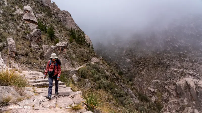
We started walking at 12:35 pm. The Maragua Crater Trek begins with an old stone-paved trail that winds down the mountainside. It’s a pre-Hispanic trail, with flat stone steps still in place along much of the way.
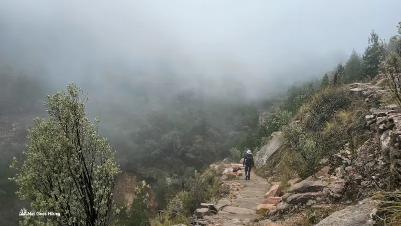
The fog made the start feel a bit mysterious. We couldn’t see much beyond the trail. The gorge and everything else were completely hidden behind the fog.
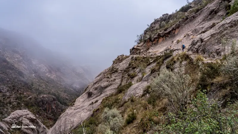
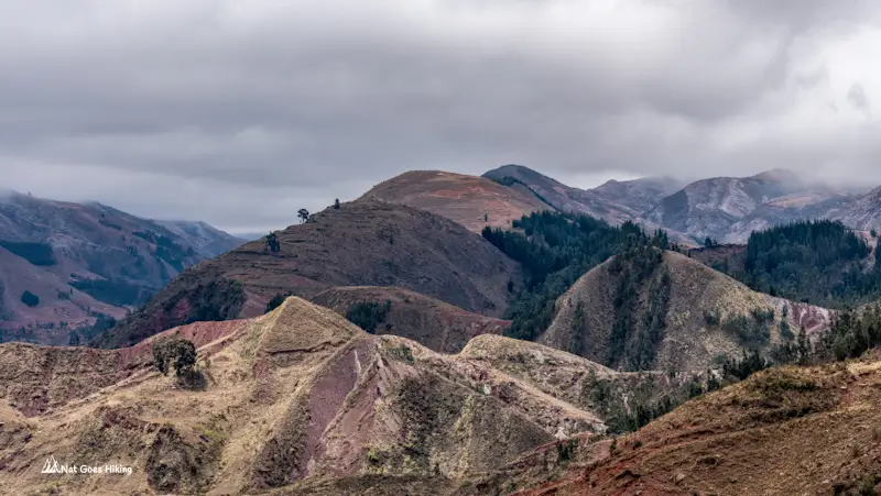
Then, about 40 minutes into the walk, the fog started to lift. Suddenly, there was a whole valley below us, with green and red mountain ranges layered behind it. The weather stayed partly cloudy for the rest of the day, which made for a much better walk.
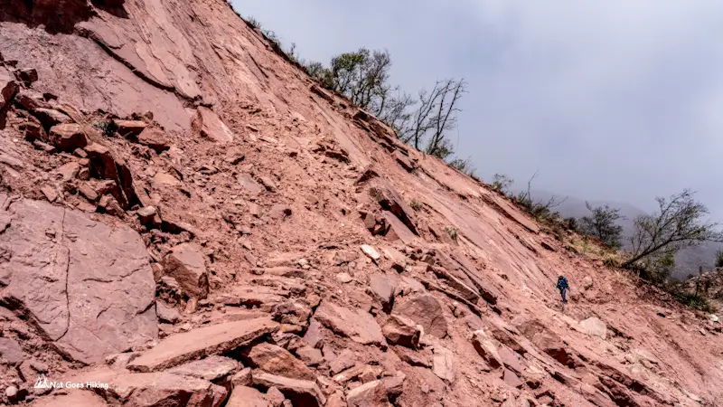
Around 2 km into the hike, we came across a landslide. It hadn’t completely blocked the trail, but the passage was narrow. We got through without any problems, though I’d be more cautious after heavy rain.
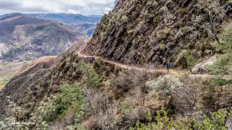
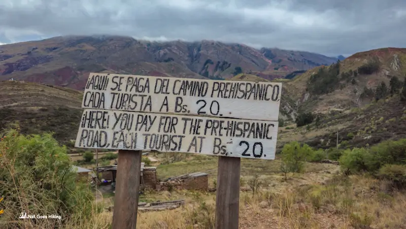
After about 4.5 km, we reached an unsealed road and a fee checkpoint. You need to register here and pay a pre-Hispanic trail fee of Bs 20. Chaunaca is another 1.3 km from here.
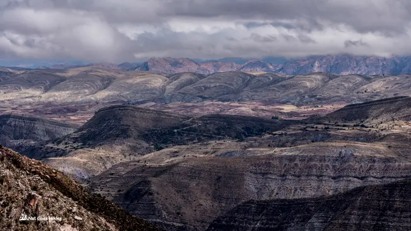
If you want to continue straight towards Maragua, you can skip the detour into Chaunaca and carry on along the route. From the checkpoint it’s roughly 12 km to Maragua, so about 16.5 km from Chataquila in total.
Staying overnight in Chaunaca
We decided to stop in Chaunaca, which added roughly 2 km to our route. Our total distance for the day was just 5.8 km, so it was an easy afternoon of walking, mostly downhill.
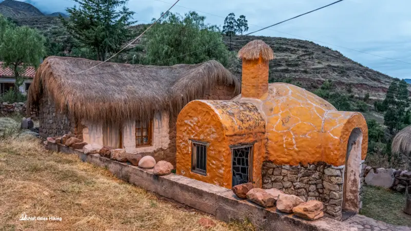
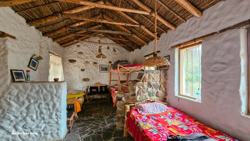
Chaunaca is a tiny community, with a church and a few scattered buildings. Right next to the church is a basic shared hut that sleeps around seven. We paid Bs 40 per person, and there were two other hikers staying there that night.
Don’t expect much. The door was too big for the frame and wouldn’t close properly. No meals here. The woman who runs it sells bottled water, drinks, and a few snacks. We paid Bs 10 for a 2l bottle of water.
If you arrive in Chaunaca with enough daylight left, you could push on towards Maragua. But if you’re happy to take the trek at a slower pace, you can stay here overnight.
Maragua Crater Trek: Day 2
Maragua Crater Trek. Day 2 Statistics
- Distance: 15 km / 9.3 mi, incl. 2.1 km/ 1.3 mi Garganta del Diablo walk
- Total time: 6 h 17 m
- Moving time: 4 h 21 m
- Elevation gain: 468 m / 1,536 ft
- Elevation loss: 282 m / 925 ft
- Starting elevation: 2,865 m / 9,400 ft
- Ending elevation: 3,052 m / 10,013 ft
- Highest point: 3,096 m / 10,157 ft
- Lowest point: 2,751 m / 9,026 ft
It was a bit chilly when we got up. We ate our own breakfast and set off towards Maragua at about 7:20 am.
Chaunaca to Socapampa Waterfall
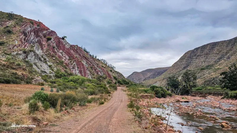
The first 1.3 km climbs through Chaunaca. Then the road drops for about 5.6 km to a bridge over the Cachimayu River. We spent a couple of hours on red dirt road and didn’t see a single car.
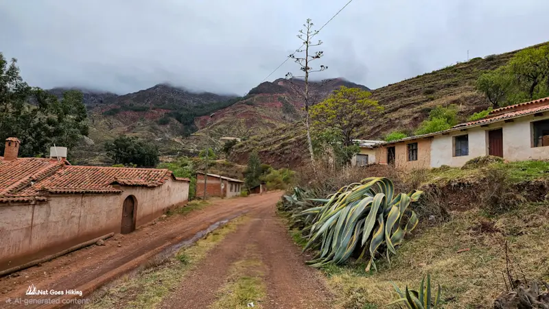
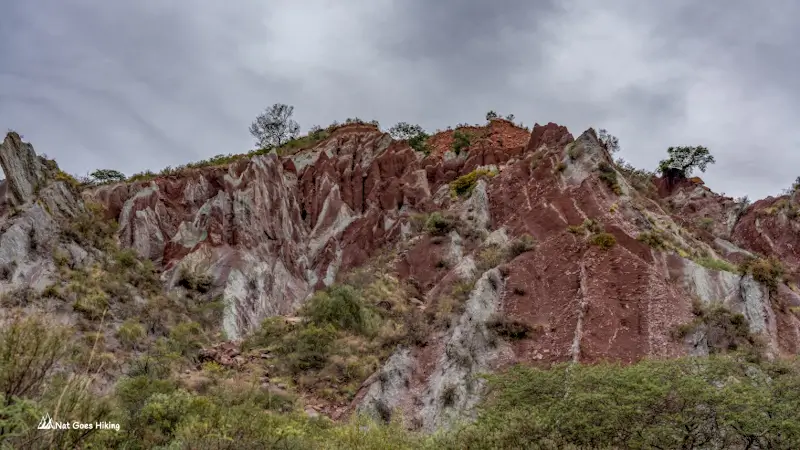
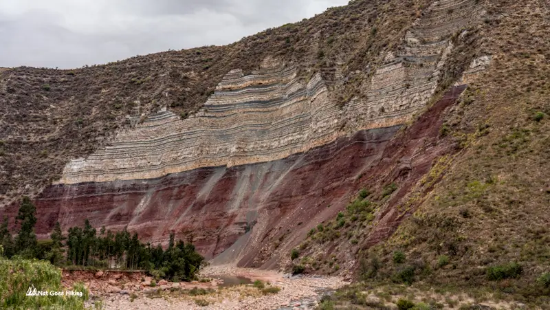
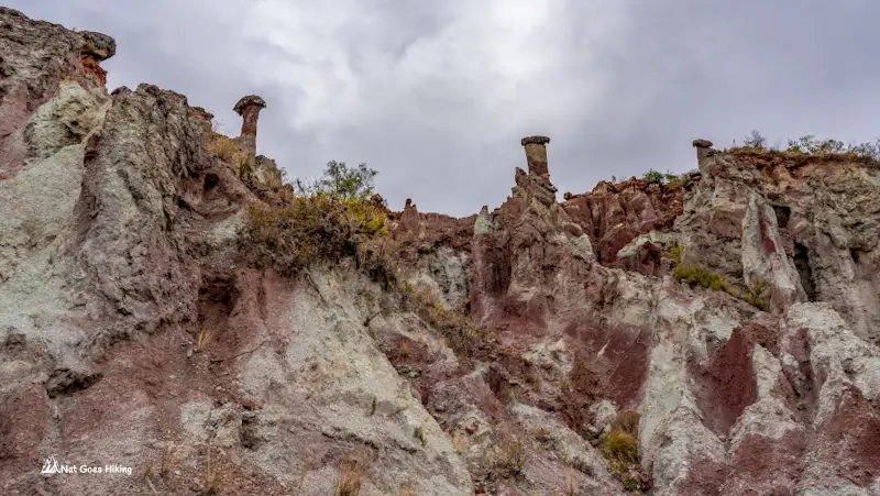
The hills were streaked rust red, maroon and pale green-grey. On our right, one cliff stopped us. A thick band of deep red at the bottom, then cream and grey layers piled on top. It looked like a slice of cake.
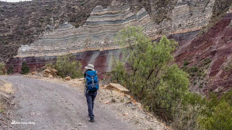
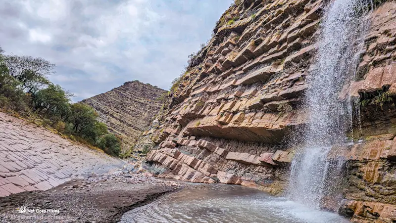
About 7 km from Chaunaca, we left the road and crossed the river on a bridge. From there, it’s a short walk to Socapampa Waterfall. It’s not a huge waterfall, but very pretty.
What makes it unusual is the rock it flows over. Thick pinkish-brown slabs form a series of steps, and the water flows down over them. On the left, the rock face looks tiled, with big flat slabs set at an angle.
The climb to Maragua
After the waterfall, we had about 3.4 km of uphill walking to reach Maragua, with around 319 m of elevation gain. This was the main climb of the day, taking us up to about 3,096 m.
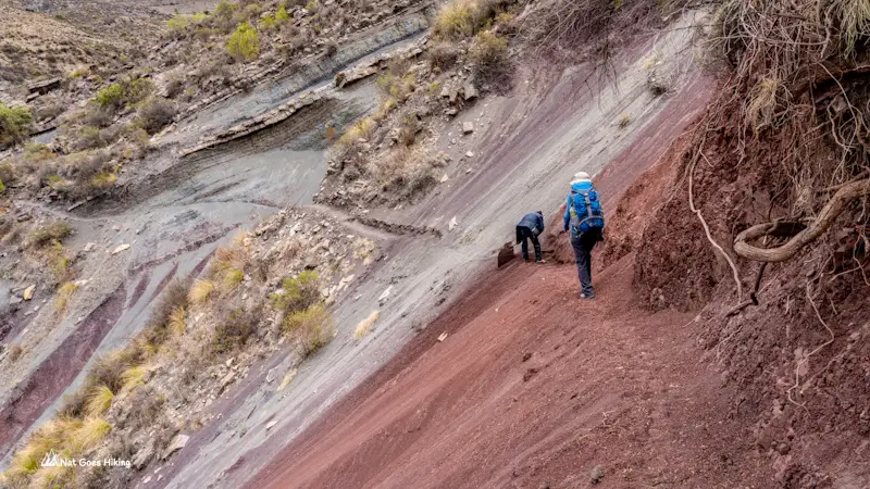
The track passed a loose slope where it looked as though a landslide had damaged the path. A local man was there, cutting the track back into the hillside.
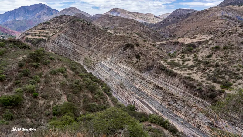
As we got closer to Maragua, the landscape became more inhabited. We passed people’s houses and saw pigs, donkeys and cows along the way.
Arriving at Maragua Crater
We reached Maragua at around 12:40 pm, 12.9 km after leaving Chaunaca.
Maragua sits in the middle of an unusual geological formation that looks like a giant crater. From the valley floor, you’re surrounded by hills with rock layers folded into wavy, striped patterns with colours ranging from pale grey and cream to ochre and reddish brown.
Look up towards the ridges and you can see the layers bending and curving around the valley. From above, these ridges form a huge bowl several kilometres across.
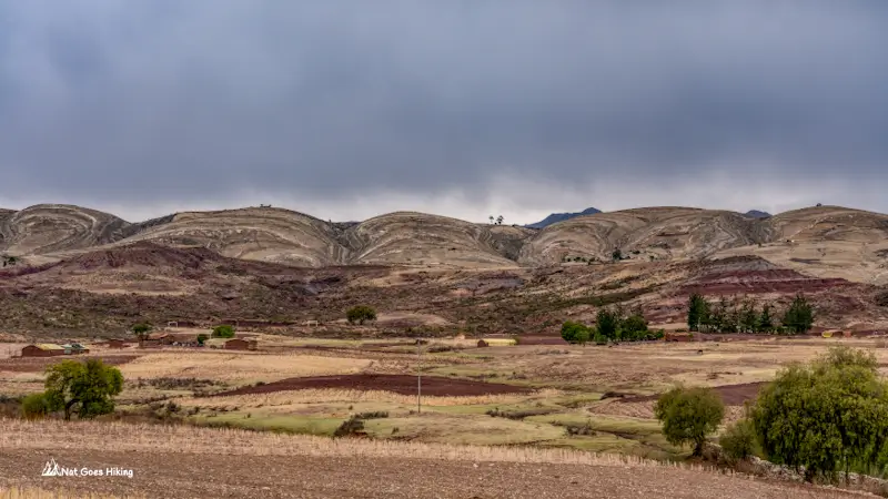
Despite its name, Maragua Crater wasn’t formed by a volcano or a meteorite. It’s part of the Maragua syncline, a large geological fold that gives the surrounding ridges their distinctive bowl-like shape.
The village itself is small, with a church, a school, and houses scattered across the valley floor. This is the Jalq’a region, known for its distinctive red and black weaving.
We stayed at Don Basilio Hostel (details in the accommodation section below).
Walk to Garganta del Diablo
After a cup of tea, we headed out to see Garganta del Diablo, about a kilometre’s walk from the hostel.
Garganta del Diablo translates as Devil’s Throat, and once you see it, the name makes sense. There’s a small cave-like opening with rocks hanging down into it like teeth.
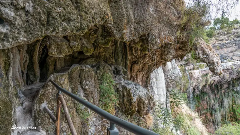
There are waterfalls nearby, too. There wasn’t much water flowing when we visited in October, but they should be much fuller during the rainy season. There’s a path leading down to the bottom, although we didn’t bother going down that afternoon and headed back to the hostel.
Dinner was simple: quinoa and fried eggs. We ate with Don Basilio, the other hikers and a guide who was leading two others through.
The little shop at the hostel sold a few basics, including beer. A 2-litre bottle of water cost Bs 12, and biscuits were Bs 8.
Maragua Crater Trek: Day 3
Maragua Crater Trek. Day 3 Statistics
- Distance: 17 km / 10.6 mi
- Total time: 5 h 14 m
- Moving time: 4 h 06 m
- Elevation gain: 494 m / 1,621 ft
- Elevation loss: 466 m / 1,529 ft
- Starting elevation: 3,052 m / 10,013 ft
- Ending elevation: 3,079 m / 10,102 ft
- Highest point: 3,375 m / 11,073 ft
- Lowest point: 3,052 m / 10,013 ft
We left at about 6 am. The day starts with a climb out of the crater, then a drop, then another climb.
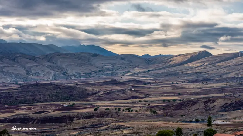
At about 4.2 km into the trail, we came across 2 black dogs who came out to the road and were quite aggressive. They barked and growled at us as we approached. There was no room to get around them. It was a bit unnerving, but we managed to get past them without any trouble.
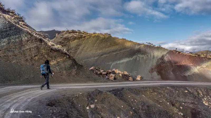
Niñu Mayu dinosaur footprints
The Niñu Mayu footprints are about 6.5 km into day 3, roughly two hours after leaving Maragua. We got there around 8 am.
We didn’t see a sign, so follow your GPS track so you don’t miss it. There may be one we overlooked. Nobody was there to collect a fee when we visited. Other hikers report paying about Bs 20 each.
The footprints are big and spread across a huge slab of rock, tilted at an angle. Several kinds of dinosaurs walked here, including sauropods, theropods and ankylosaurs. This was in the Late Cretaceous. Their prints were pressed into soft sediment, which later hardened into rock. Over time, movement in the earth tipped the layers, which is why the prints now sit on a slope instead of flat ground.
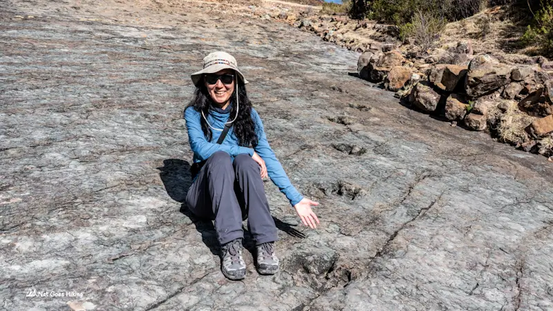
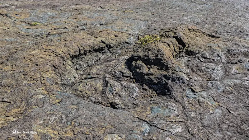
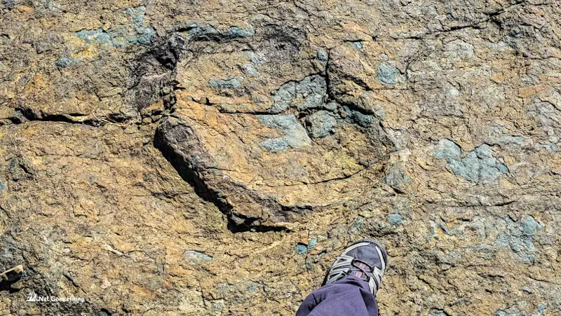
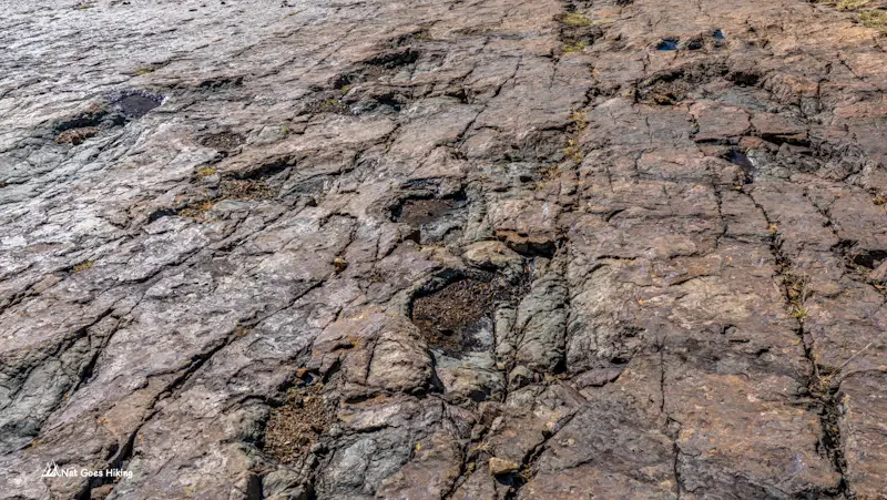
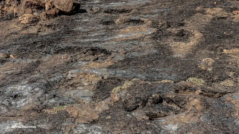
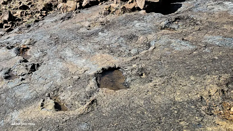
Before Maragua, we’d seen footprints at Toro Toro National Park and Parque Cretácico in Sucre. Here, we had the whole slab to ourselves.
The final climb, then downhill to Potolo
After the footprints, the trail climbs again. We gained about 120 m in only 800 m, reaching 3,375 m, the highest point of the day. That’s the last proper climb. From here it’s downhill.
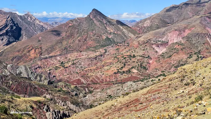
About 9.5 km to go. The views made it easy. Red and white striped hills, with rock folded like a scrunched-up blanket. We rolled into Potolo in about 2.5 hours at around 11 am.
Getting from Potolo back to Sucre
Potolo is where you catch a combi back to Sucre. They depart from the main square. As of October 2026, according to recent Google reviews, the fare is Bs 30.
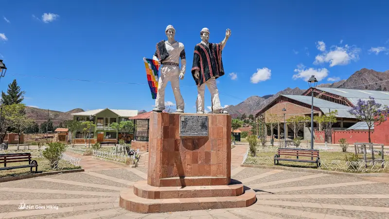
We waited for more than two hours. The square slowly filled with people carrying bags, sacks of potatoes and bundles wrapped in colourful traditional cloth. About an hour in, a combi arrived, and everyone rushed it, only to find out it wasn’t the one going to Sucre. I started wondering how hard it would be to get a seat when the right one turned up.
It came after 1 pm, and there was room for everyone. We did a lap of the village first to pick up a few more passengers.
There’s a small stall on the square selling almuerzo (a set lunch), along with snacks and drinks, so you can get something to eat while you wait.
Don’t leave your return journey until the last minute. Combis from Potolo to Sucre don’t follow a strict timetable, and the last departure is reported to be around 4 pm, although this can vary. Aim to arrive in Potolo well before then. Allow extra time for the wait and bring some cash for the fare.
Accommodation on the Maragua Crater Trek
Accommodation in Maragua is basic. Most places are small, family-run hostels with simple rooms, shared bathrooms and home-cooked meals. Don’t expect hotel comforts, and be prepared for occasional water shortages and cold showers.
Most hostels offer dinner and breakfast as part of a package, so you can usually get a bed and meals in one place. They also sell basic supplies, such as bottled water, soft drinks, beer, and snacks. The selection is limited, so if you need anything particular, I’d bring some extra snacks from Sucre.
| Place and contact details | Price per person (as of October 2026) |
Notes |
|---|---|---|
|
Albergues de Chaunaca, Chaunaca +591 652 574 17 |
Bs 40 bed only |
We stayed here Shared hut for about 7 people. No meals. Sells water, drinks and snacks. |
|
Hospedaje Don Basilio, Maragua +591 464 352 40 |
Bs 50 includes bed, dinner, breakfast |
We stayed here We paid Bs 40 for bed and dinner and skipped breakfast. Private rooms with two or three beds and a dormitory. Plenty of blankets. Friendly owner. Little shop on site. We skipped the shower because it was cold. |
|
Nativus Hostel, Maragua +591 714 134 60 |
Bs 50 includes bed, dinner, breakfast |
Based on Google reviews Private rooms with two or three beds. Friendly hosts. Some say the meals are small. Shower may be cold. |
|
Hostal Inti Wasi, Maragua +591 744 206 65 +591 686 425 44 |
Bs 80 includes bed, dinner, breakfast |
Based on Google reviews Warm blankets and home cooking. Reviews mention an electric, lukewarm shower. Some say portions are small. |
|
Hostal Samary Wasi, Maragua +591 744 358 43 |
Bs 100 includes bed, dinner, breakfast Camping Bs 30 Dome huts Bs 350 |
Based on Google reviews Rooms with three beds. Showers can be cold depending on water and weather. Good reviews for the food, though some say portions are small. |
Do you need to book accommodation in advance?
We didn’t book accommodation in Chaunaca or Maragua in advance, as we prefer to keep our plans flexible. Things didn’t go quite as planned, though. We arrived at the trailhead around lunchtime, so we decided to spread the trek over three days instead of two.
We didn’t have any trouble finding a place to stay along the way. The Maragua Crater Trek doesn’t seem to get that many visitors, so booking ahead isn’t essential.
In Bolivia, most hostels take bookings on WhatsApp. If you have a particular hostel in mind, it’s worth contacting them in advance.
Supplies on Maragua Crater Trek
Food and drinks
There’s nothing to buy at Chataquila. Bring food and water for the first stretch, to Chaunaca (5.8 km) or Maragua (about 16.5 km if you skip Chaunaca, about 18.7 km if you stay there).
Chaunaca and Maragua hostels sell water, drinks, crackers, biscuits and snacks. It’s not a proper shop.
In Chaunaca, our hostel didn’t provide meals, but in Maragua, dinner and breakfast are usually included in the accommodation price. The food is basic. Expect soup, rice, quinoa, potatoes, pasta, eggs or vegetables. Breakfast is bread, fried dough, eggs and fruit. Portions vary.
At Don Basilio Hostel, we had quinoa with fried eggs for dinner, but skipped breakfast, as we left early. I’d bring some snacks for the walk and something for lunch, too. You can’t count on finding somewhere to buy food along the trail.
Natural water sources
There aren’t many natural water sources along the Maragua Crater Trek.
River water is a last resort. You meet the Cachimayu River about 7 km after Chaunaca. It was murky and reddish-brown with sediment. The waterfall water looked a bit better but was still cloudy, and a waterfall doesn’t make water safe. It’s farming country, with animals and villages upstream. If you must use it, let the sediment settle, filter it, then treat or boil it.
We brought bottled water from Sucre for the first day, topped up in Chaunaca and carried enough to get us to Maragua. Far easier than treating water on the move.
Maragua Crater Trek costs
Here’s a breakdown of the Maragua Crater Trek costs for two people without a tour. It covers transport, entrance fees, hostels, and food and drinks we bought in the hostels we stayed in. Transport, fees, and hostel prices are for October 2026, based on recent Google Maps reviews. Combi fares are up since we hiked it in October 2025 because of petrol prices, so we paid a bit less back then. According to Google reviews, entrance fees and hostel prices are the same as in 2025.
- Taxi in Sucre: Bs 15
- Combi from Sucre to Chataquila: Bs 25 × 2 = Bs 50
- Combi from Potolo to Sucre: Bs 30 × 2 = Bs 60
- Combi on the way back to the centre of Sucre: Bs 2 × 2 = Bs 4
- Pre-Hispanic trail: Bs 20 × 2 = Bs 40
- Niñu Mayu dinosaur footprints: Bs 20 × 2 = Bs 40 (there was no one to collect the fees when we were there)
- Chaunaca: Bs 40 × 2 = Bs 80 (bed only)
- Maragua: Bs 50 × 2 = Bs 100 (bed, dinner, and breakfast)
- Water 2L in Chaunaca: Bs 10
- Water 2L in Maragua: Bs 12
- Biscuits in Maragua: Bs 8
* This breakdown doesn’t include the cost of food and drinks we brought from Sucre.
Maragua Crater Trek FAQ
No. We hiked it independently and it went fine. Combis run to Chataquila and back from Potolo, and there are hostels in Chaunaca and Maragua, so you don’t need to carry a tent. The main thing you need is an offline map and the GPX track. The trail isn’t marked and mobile coverage can drop out. If that sounds like too much uncertainty, I’d hire a local guide.
You can complete the Maragua Crater Trek in 2 or 3 days, depending on your pace, where you spend the night, and what time you arrive at the trailhead. We did it over 3 days because we arrived at the trailhead around lunchtime and decided to stay in Chaunaca on the first night and Maragua on the second. If you arrive early, you can easily skip Chaunaca and reach Maragua on Day 1.
The Maragua Crater Trek is moderately difficult. The distance from Chataquila to Potolo, depending on the route, is around 34-38 km, usually spread over 2-3 days. There are some ups and downs along the way, but they’re mostly gradual. You’ll also be hiking above 3,000 m for much of the trek, which can make walking more tiring. There’s no need for technical hiking skills, but a reasonable level of fitness will help.
No, you don’t need camping gear for the Maragua Crater Trek. You can stay in basic family-run hostels in Chaunaca and Maragua. In Maragua, hostels provide dinner and breakfast. This means you can do the trek without carrying a tent, sleeping bag, or cooking equipment.
Related posts
Want more inspiration for travel in Bolivia? Check out these posts:

Planning the El Choro Trek independently? My guide covers our 3-day itinerary, campsites, water sources, and other practical tips.
Sajama National Park is Bolivia’s hidden gem. This travel guide covers what to do, how to get there, where to stay, and useful tips from our experience.
Planning a trip to Salar de Uyuni? Discover what to expect, the best time to visit, and whether to go independently or join a tour..
Although Bolivia is one of the most underrated countries, it has so much to offer. Wondering what the top things to do in Bolivia are?