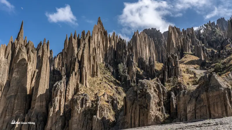
Just outside La Paz, there’s a huge area of strange, eroded clay and sediment formations that look almost like something from another planet. Valle de las Ánimas Hike, also known as the Valley of the Souls, is one of the most unusual landscapes near the city, yet it’s still relatively little visited.
We explored it independently in September 2025, hiking a 9.3 km semi-loop through the valley. In this guide, I’ll explain how to get there by public transport and what to expect on the trail.
Valle de las Ánimas Hike at a Glance
Valle de las Ánimas Hiking Routes
There are several ways to explore Valle de las Ánimas, depending on how much time you have:
Short visit: Walk from the main entrance along the jagged spires for 1-3 km and return the same way.
Longer hike: Continue further into the valley, following the gravel road and climbing towards higher viewpoints.
Mirador Alaxpacha route: Start at the main entrance and continue towards Alaxpacha Lookout (Mirador Alaxpacha).
Semi-loop: Start at the main entrance, hike up the valley, loop around the upper section, and descend towards Quebrada Negra.
We hiked the semi-loop, starting at the main entrance and finishing in Quebrada Negra.
Valle de las Ánimas Hike: Quick Facts
- Trail type: Semi-loop one day-hike
- Nearest city: La Paz
- Public Transport availability: Yes
- Distance: 9.3 km / 5.8 mi
- Moving time: 3h 05m
- Total time: 5h 05m
- Elevation gain: 574 m / 1,883 ft
- Elevation loss: 530 m / 1,739 ft
- Starting elevation: 3,754 m / 12,316 ft
- Ending elevation: 3,798 m / 12,461 ft
- Min elevation: 3,754 m / 12,316 ft
- Max elevation: 4,331 m / 14,209 ft
- Difficulty: Moderate
- Best season: Dry season (May to September)
Click the button below to download the Valle de las Ánimas Hike GPX file.
How to get to Valle de las Ánimas trailhead
You can reach Valle de las Ánimas by public transport from central La Paz. There are two options: a local minibus to Chasquipampa or the larger Puma Katari bus.
We initially planned to catch the Puma Katari bus from Plaza Camacho. Unlike traditional shared minibuses that stop anywhere, Puma Katari buses operate strictly at designated bus stops and have a timetable.
But when we arrived at the bus stop, we were told that the next bus would only leave at 9 am. I am not sure if it was so because it was Saturday or related to something else. Anyway, we walked to Avenida 16 de Julio to catch a minibus instead.
Look for a minibus with a Chasquipampa sign on the windscreen. It was a bit difficult to get on because most passing minibuses were already full. Eventually, we managed to get one at around 8 am.
You need to get off at Calle 63. Once you start approaching, ask the driver to drop you off there. It took us about 40 minutes, and we paid Bs 3 per person.
Alternatively, you can take the Puma Katari bus from Plaza Camacho. Get off at its final stop in Chasquipampa. This bus is slower, but is more comfy. The journey takes around an hour, and the fare is Bs 3.50 in 2026.
From Calle 63, walk uphill through the residential area for about 10 minutes. The main entrance is near the intersection of Avenida Circunvalación and Avenida C. Arenal. See the Google Maps pin below.
Entrance fee to Valle de las Ánimas
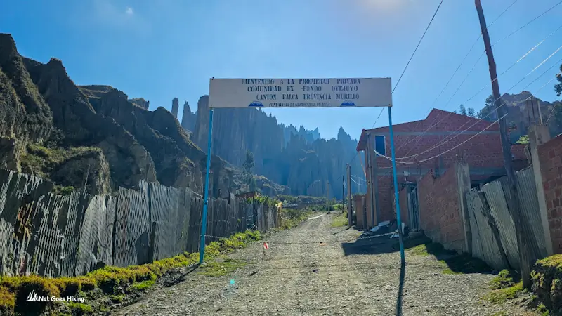
When we reached the trailhead, there was a sign indicating that the area is private property. We did the hike in 2025, and there was no one to collect the entrance fee.
As of November 2026, there’s a booth with a price board: 5 Bs for Bolivians, 10 Bs for foreigners. There’s also a paid toilet for 3 Bs.
What to Expect on the Trail
We hiked the semi-loop, starting at the main entrance and finishing in Quebrada Negra. It was a longer walk, covering 9.3 km in total, but I think it’s worth exploring further if you have the time. The views on the way down are different from those at the beginning of the hike. It took us 5 hours and 5 minutes in total, including breaks, with 3 hours and 5 minutes of moving time.
There’s no marked trail and no signs, so download an offline map and GPS track.
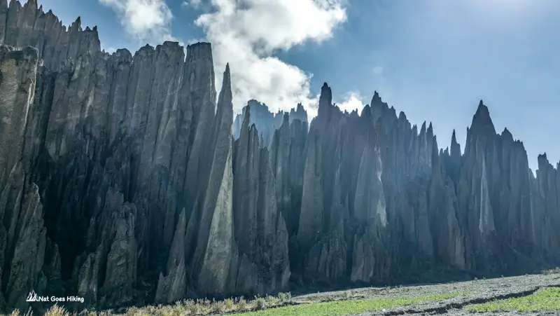
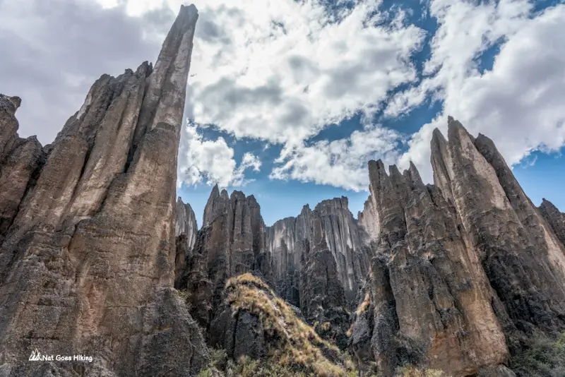
The best-known view of Valle de las Ánimas, with its sharp, jagged spires rising above the valley, is less than 1 km from the entrance.
Don’t miss the lookout, as we did. About 800 m in, there’s a short climb to the right. We didn’t know about it and obviously missed it. The climb is short, but this viewpoint gives you a different angle and a better view of the Valle de las Animas spires.
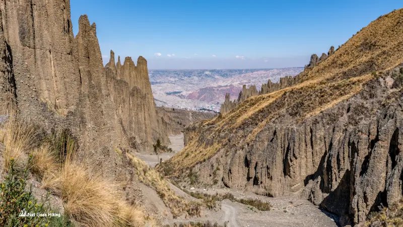
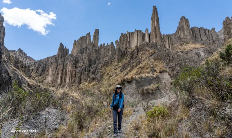
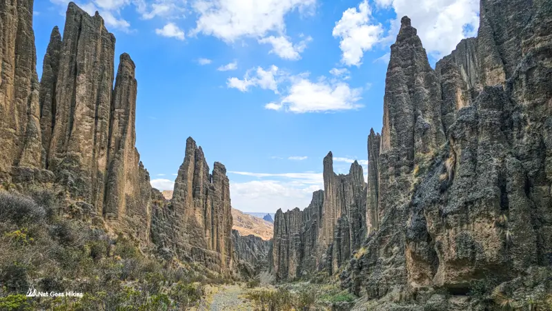
We followed the gravel road further into the valley. It’s possible to go by car further into the valley for at least 4 km. For much of the hike, the spires were on both sides of us.
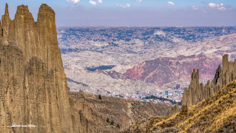
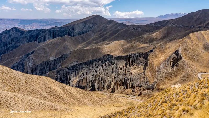
The route gradually climbs towards the highest point at 4,331 m for about 4.7 km. As you gain elevation, the views change. Look back occasionally, as you can see La Paz spread out below you.
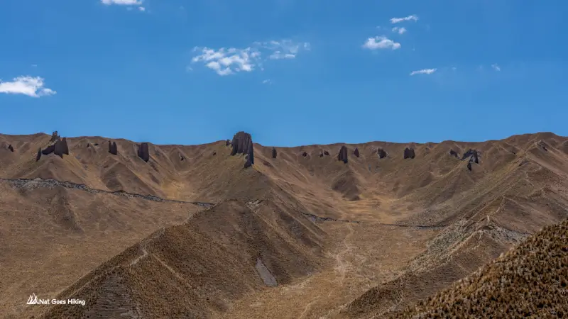
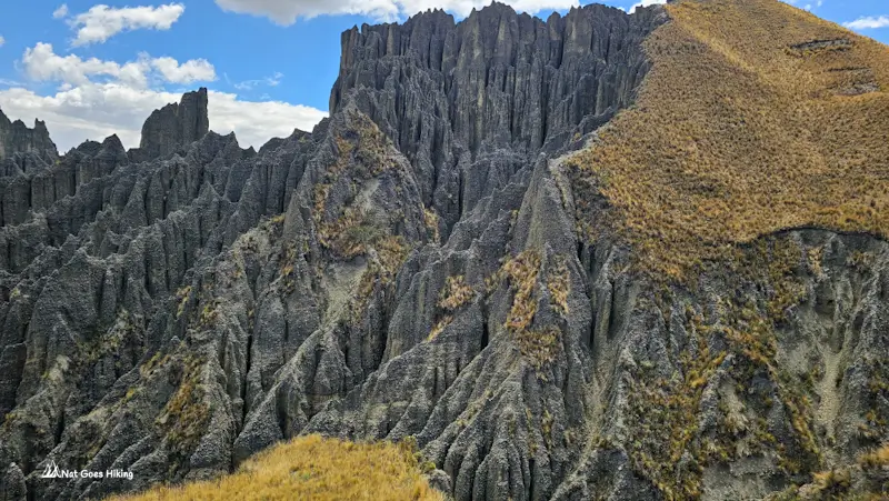
The descent was a little more challenging. Some sections of the trail were a bit confusing, as they had washed out, and we had to do a bit of scrambling. If you prefer to avoid scrambling and are not confident with navigation, I’d suggest doing an out-and-back hike instead of completing the loop.
Getting back to La Paz
Once you reach the residential area, continue downhill towards the main road. You can flag down a shared minibus heading towards central La Paz anywhere along the route. Check the destination signs on the windscreen or ask the driver if it goes to the centre before getting on. We paid 3 Bs per person.
Is Valle de las Ánimas worth visiting?
Absolutely. If you’re spending a few days in La Paz and enjoy hiking, I’d definitely include it in your plans.
You don’t have to travel far to find yourself walking among enormous eroded formations, with views stretching towards La Paz.
I’d allow at least half a day for the longer route, and if you’re short on time, the shorter walk is a good option.
Things to know before you go
- Altitude: The hike reaches 4,331 m, so it’s best to allow yourself time to acclimatise in La Paz before attempting it.
- Navigation: Trails are unmarked, and there are several route variations. Download an offline map or GPS track before leaving.
- Safety and weather: Stick to the dry season if possible. Avoid hiking during or immediately after heavy rain, as the terrain and river channels can become dangerous. Also, the sediment formations can become unstable, with a risk of erosion and slope collapses. Don’t climb on the eroded spires or approach unstable edges just to get a photo.
- Water and food: There are no shops along the trail. But you can find shops on the main road after you get off a minibus.
- Toilets: Paid toilets are available at the trailhead
FAQ
Moderate. The distance ranges from 5 to 14 km, depending on the route. Our hike was 9.3 km, with 574 m of elevation gain and a highest point of 4,331 m. The altitude makes the uphill sections more challenging, while parts of the descent can be confusing and rough. Some sections of the trail are washed out, so expect a bit of scrambling.
No. Valle de la Luna (Moon Valley) is a separate formation, also in southern La Paz. Valle de la Luna is a smaller, more developed and touristy site with marked walking paths and boardwalks, while Valle de las Ánimas is a much larger area of rock spires with unmarked hiking trails.
No, you can visit Valle de las Ánimas independently. However, the trails are unmarked, and there are several route variations, so I’d recommend downloading a GPS track before you go. If you’re not confident navigating on your own, guided tours from La Paz are available. Some combine Valle de las Ánimas with Valle de la Luna or Palca Canyon.
Related posts
Want more inspiration for travel in Bolivia? Check out these posts:

Planning the El Choro Trek independently? My guide covers our 3-day itinerary, campsites, water sources, and other practical tips.
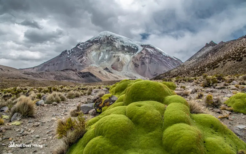
Sajama National Park is Bolivia’s hidden gem. This travel guide covers what to do, how to get there, where to stay, and useful tips from our experience.

Planning a trip to Salar de Uyuni? Discover what to expect, the best time to visit, and whether to go independently or join a tour..
Maragua Crater Trek without a guide: our 3-day route with GPX, how to get to the trailhead, combi fares, hostels and costs breakdown.
Although Bolivia is one of the most underrated countries, it has so much to offer. Wondering what the top things to do in Bolivia are?